Sattappadi Fm
Type Locality and Naming
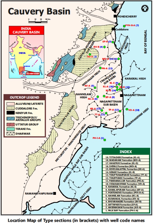
SUBSURFACE: The type section is located at exploratory well Sattappadi-A, in the Ariyalur-Pondicherry subbasin (depth interval: 3290-3860 m). Hypostratotype is in the well Andimadam-A (depth interval: 3160-3590 m). It was named after the Sattappadi village by ONGC team steered by Venkatarengan et al., (1993) and issued as Document-VII by KDMIPE, ONGC, Dehradun (1993).
[Figure 1: Type-section Map of Subsurface Formations]
Lithology and Thickness
Claystone and minor sandstone. The Sattappadi Formation comprises of mainly silty shale and minor calcareous sandstone alternations. The shale is dark gray to black, compact, moderately hard with abundant biotite, fissile, often silty, calcareous sandstone is gray, hard, compact, fine- to coarse-grained, ill-sorted, subangular to subrounded, quartz, feldspar and garnet are set in a calcareous cement. Thickness varies from 400-600 m+.
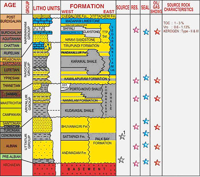
[Figure 2: Generalized Stratigraphy and Petroleum System of Cauvery Basin (from dghindia.gov.in)]
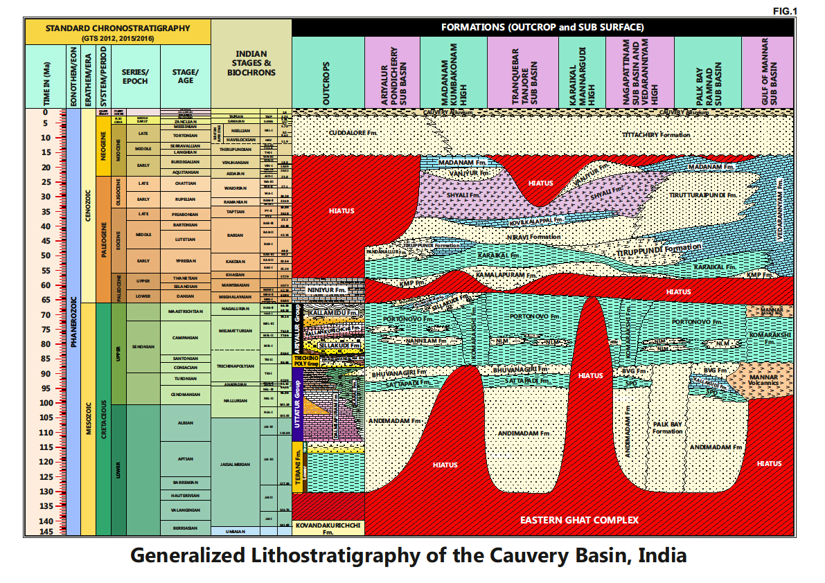
[Figure 3: Generalized Stratigraphy of Cauvery Basin (Provided by A. Nallapa Reddy & R. Nagendra)]
Relationships and Distribution
Lower contact
Unconformable with Andimadam Fm.
Upper contact
Conformable with Bhuvanagiri Fm.
Regional extent
Entire basin: Present in the entire basin, and partly correlates (biostratigraphicly) with upper portions of the combined Dalmiapuram Fm / Karai Fm in the outcrops.
GeoJSON
Fossils
Age
Depositional setting
Outer neritic-Upper bathyal.
Additional Information
Shale lithologies are potential source facies for hydrocarbons. This lithologic unit was developed during a major marine transgression of the Dalmiapuram cycle.


